Master-Planned Foothill Community
Welcome to Stevenson Ranch, a master-planned community set in the foothills of the Santa Susana Mountains, just west of Santa Clarita.
Stevenson Ranch is an unincorporated community in the Santa Clarita Valley of Los Angeles County, occupying about 6.4 square miles in the foothills of the Santa Susana Mountains. It lies immediately west of Interstate 5 and the city of Santa Clarita, and it is among the newest large communities in the valley. Its development was approved by the county Board of Supervisors in 1985, and it has since grown into a comprehensive residential area of roughly 20,000 residents. The community's setting is closely tied to the land's earlier history. Nearby Pico Canyon was the site of Mentryville, a company oil town founded in the 1870s during California's early petroleum boom, and that heritage remains a local reference point. Modern Stevenson Ranch was conceived from the outset as a master-planned community, with a network of subdivisions integrated around parks, open space, and arterial roads rather than developed incrementally. About 1,000 acres are set aside as parks, recreation areas, and open space, an unusually high proportion for a suburban community. Today Stevenson Ranch functions as a family-oriented residential area on the western edge of the Santa Clarita Valley. Its planned parks and trail system, newer housing stock, and strong local schools attract residents seeking a foothill setting with access to the Interstate 5 corridor. Because it is unincorporated, it is governed by Los Angeles County rather than its own city government, yet it remains closely connected to Santa Clarita for shopping, services, and regional amenities. Elementary students attend the Newhall School District, while secondary students are part of the William S. Hart Union High School District, the high school district serving the broader valley. The community's planned, uniform character and its position against the mountains give it a distinctive identity within the valley. It offers a quiet, landscaped residential base with direct freeway access to the rest of Los Angeles County, making it a practical choice for commuters and families alike.
Stevenson Ranch is an unincorporated community in Los Angeles County, California. It is located in the Santa Clarita Valley, set in the foothills of the Santa Susana Mountains just west of the city of Santa Clarita and Interstate 5.
No. Stevenson Ranch is unincorporated and governed by Los Angeles County rather than the city of Santa Clarita, although it sits immediately adjacent to the city and relies on Santa Clarita for many shopping, dining, and service amenities.
Elementary students in Stevenson Ranch attend the Newhall School District, which operates Stevenson Ranch Elementary within the community. Secondary students attend schools in the William S. Hart Union High School District, the large district serving the Santa Clarita Valley.
Stevenson Ranch lies roughly 30 miles northwest of downtown Los Angeles, reached primarily via Interstate 5 through the Newhall Pass. For commuters, Metrolink rail service is available at stations in nearby Santa Clarita.
Stevenson Ranch is known as a master-planned community set in the foothills of the Santa Susana Mountains, with about 1,000 acres of parks and open space and a history connected to Mentryville, the 1870s oil town in nearby Pico Canyon.
City Guide
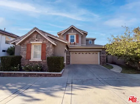
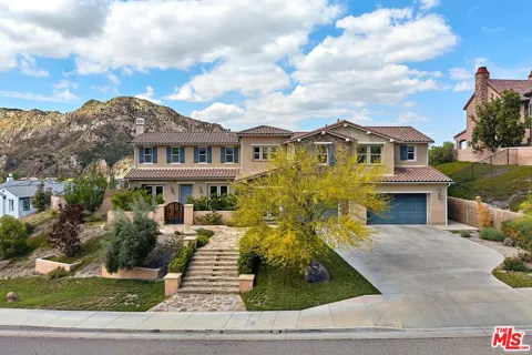
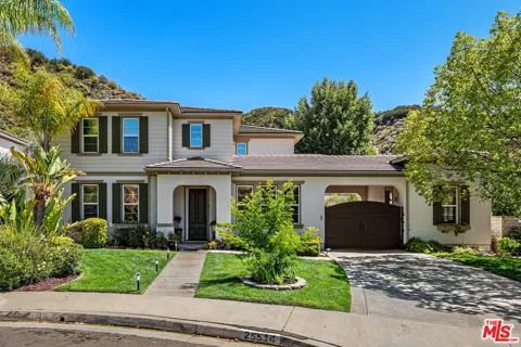
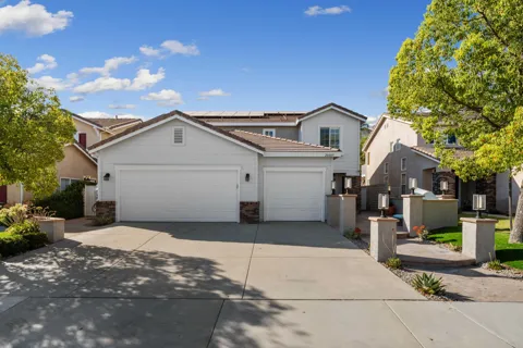
As a master-planned community, Stevenson Ranch's housing stock is predominantly newer single-family construction, much of it built from the late 1980s onward as the community developed in phases. The area comprises roughly 46 named neighborhoods, the majority north of Pico Canyon Road with a smaller group to the south. Homes are typically set within planned subdivisions with community parks and open space woven through the development, and many neighborhoods are governed by homeowners associations. The overall character is uniform and landscaped, with a clear emphasis on family housing, sidewalks, and integrated recreational areas rather than the varied, older inventory found in more historic parts of the valley.
Stevenson Ranch is organized as a collection of about 46 distinct neighborhoods, most of them north of Pico Canyon Road and a smaller number south of it. Each neighborhood is a planned subdivision with its own street pattern, common areas, and in many cases a homeowners association. The design creates a series of self-contained residential enclaves connected by major boulevards and surrounded by open space. The community's master plan reserves roughly 1,000 acres for parks, recreation, and natural areas, so green space is distributed throughout rather than concentrated in one place. This structure gives Stevenson Ranch a consistently planned, cohesive feel across its different neighborhoods.
Life in Stevenson Ranch is centered on a planned, family-oriented suburban rhythm. Residents rely on the community's parks, trails, and open space for daily recreation, and the area's schools are a central draw for households with children. As an unincorporated community, Stevenson Ranch leans on adjacent Santa Clarita for much of its retail, dining, and entertainment, giving residents a quiet residential base with easy access to the valley's larger commercial centers. The foothill setting offers mountain views and quick access to nearby canyons and open country, while the community's newer, landscaped neighborhoods provide a tidy, uniform streetscape distinct from older parts of Los Angeles County.
Stevenson Ranch is served by two districts. Elementary students attend schools in the Newhall School District, which operates Stevenson Ranch Elementary within the community and serves several surrounding Santa Clarita neighborhoods. Secondary students attend schools in the William S. Hart Union High School District, the large high school district covering the Santa Clarita Valley. This arrangement places Stevenson Ranch residents within the same well-regarded public school system as the broader valley, and the presence of neighborhood elementary campuses keeps younger students close to home. The quality of local schools is frequently cited as a key reason families choose the community.
Stevenson Ranch sits directly west of Interstate 5, the principal north-south freeway through the Santa Clarita Valley, giving residents direct highway access to the rest of Los Angeles County and to the north. The community is positioned in the valley's western foothills, with major surface boulevards connecting it to Santa Clarita's commercial districts. For commuters, the I-5 corridor is the dominant route, though travel can be affected by conditions through the Newhall Pass. Regional Metrolink rail service is available at stations in nearby Santa Clarita, providing a commuter rail option into the Los Angeles area.
Recreation is a defining feature of Stevenson Ranch, where roughly 1,000 acres are set aside as parks, recreation areas, and open space. The community's master plan threads neighborhood parks, greenbelts, and walking trails through its subdivisions. The surrounding Santa Susana Mountains offer foothill hiking and open country immediately adjacent to the community, and nearby Pico Canyon provides access to the historic Mentryville site and additional trailheads. The Angeles National Forest lies within reach for more extensive outdoor recreation. This combination of planned neighborhood parks and immediate access to mountain open space is central to the community's appeal.
MARKET SNAPSHOT
How homes have been selling here over the last 90 days.
Market data reflects closed sales over the last 90 days and is provided for informational purposes.
BROWSE BY ZIP
Browse listings by postal code in this area.